Posts

Where are most deserts found?
Image
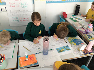
 This week, the children recapped the definition of a desert as well as understanding that not all deserts are hot. Then, they used their knowledge of the lines of latitudes: Tropic of Cancer, Equator and Tropic of Cancer. The children identified that the areas between the two lines of latitude is known as the Tropics. Here, the climate is hot and warm. There are not many clouds in the desert at night which means that the climate will be cold then. As we expect the climate to be warm there most of the deserts we looked at today are warm in the day. Following this the children used their atlases to locate different deserts in the world.  An amazing lesson year 4, lots of dojos handed out today. 

French: lesson 6: using il me faut

Image
 Year 4 revised everything they’ve learnt so far including singing their song and a new song all about stationery. They learnt a sentence structure: pour ……. Il me faut. Using verbs and stationery  which translates, for example, for writing, one will need a pen  The children practiced saying this, changing the verbs and nouns. They then chose appropriate words to fill in. 

In the Desert

Image
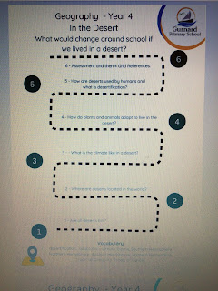
 This term, the children are learning all about deserts.  The children were introduced to the journey of knowledge for this unit.   Then , they were given 4 photos to discuss which one they thought was a desert and which weren’t. Some very interesting comments and ideas. Which ones do you think are deserts? All of these pictures show a type of desert.  Deserts receive less than 25cm or 250mm of precipitation a year. Using a ruler the class looked at how little that was. One child commented that we definitely don’t live in a desert as we have had more rain than that this year!he was correct as on average England has 1200mm of precipitation a year. A big difference. I 

What does The United Kingdom offer us?

Image
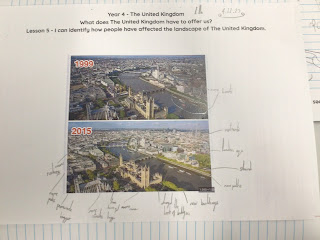
 This week, the children looked at two different aerial photos of London from 1999 and 2015. They discussed how man has changed the environment. They found new buildings, landforms as well as identifying how new roads, bridges, hotels and train lines have been built over the years to cope with the many people living in London and the tourists.  Lastly, they had to identify what The United Kingdom has to offer us. Some lovely work by all. 

What are the British Isles.

Image
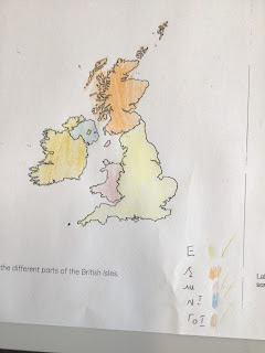
 Only one class completed the geography lesson this week as we had RE Day.  This week the children began identifying what parts make up the British Isles. They discussed why some parts are included in a geographical perspective such as Isle of Man and Ireland.  They then looked at the famous rivers and mountains in The United Kingdom and the children located them on a map. Some children discussed visiting the rivers and one child had even climbed Scafell Pike!

Which region do we live in?

Image
 This week’s lesson had the children identifying what a region is and what region do they live in as well as  locating some of the famous cities in The United Kingdom.  The children were told that a region is like an area in their playground. There are areas for sand, mud, building and cycling. The United Kingdom is split into areas so it is easier to find out data and information about that area (administrative). Using their compass points they identified each region and hopefully they will remember that they live in the South East region. Then, they recapped the capital cities of the four countries making up the United Kingdom as well as identifying different cities ( we used our knowledge of sports teams and holidays to help us).